Scopri · Capoterra
Il Territorio
Caput Terrae, la prima terra dopo la laguna sulla via per Nora.
Capoterra (Cabuderra in Sardinian) lies on the western arm of the Gulf of Angels, 15 kilometres from Cagliari. The name comes from the Latin Caput Terrae — 'head of the land' — because it was the first land encountered after the Santa Gilla lagoon when arriving from the regional capital.
Inhabitants
23.088
Area
68,49 km²
Elevation
54 m s.l.m.
From Cagliari
15 km
Postal code
09012
Area code
070
ISTAT code
092011
Coordinates
39.18° N · 8.97° E
I tre nuclei
Capoterra has three inhabited centres, each founded in a different era.
- The historic hillside centre, the original nucleus from 1655, nestled at the foot of the Montarbu, Punta Sa Loriga and Monte Arrubiu hills. The earliest streets bore Sardinian names: Sugaminu (today Corso Gramsci), Sustrintu de Mesoida (Via Roma), Sugamminu de Subiginao de Susu (Via Indipendenza). Here stand the parish church, the town hall and the oldest houses, including Sa Domu de is Pianus, dating from 1660.
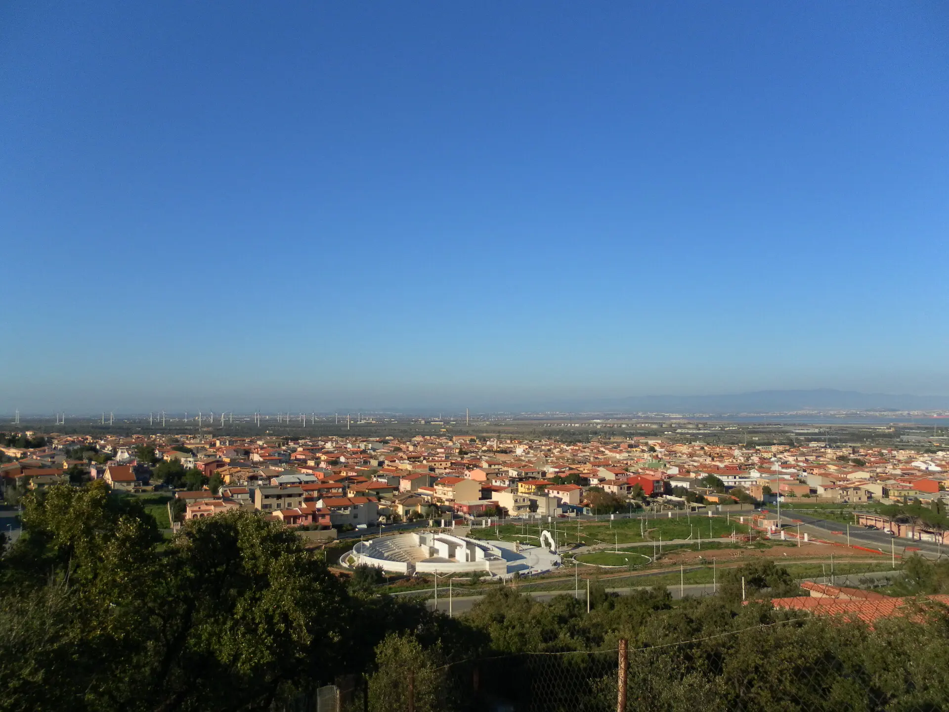
- The coastal strip, developed from the 1960s as a residential area for people from Cagliari. Eight hamlets line the shore. Agricultural and pastoral land turned into building plots within the span of two decades.
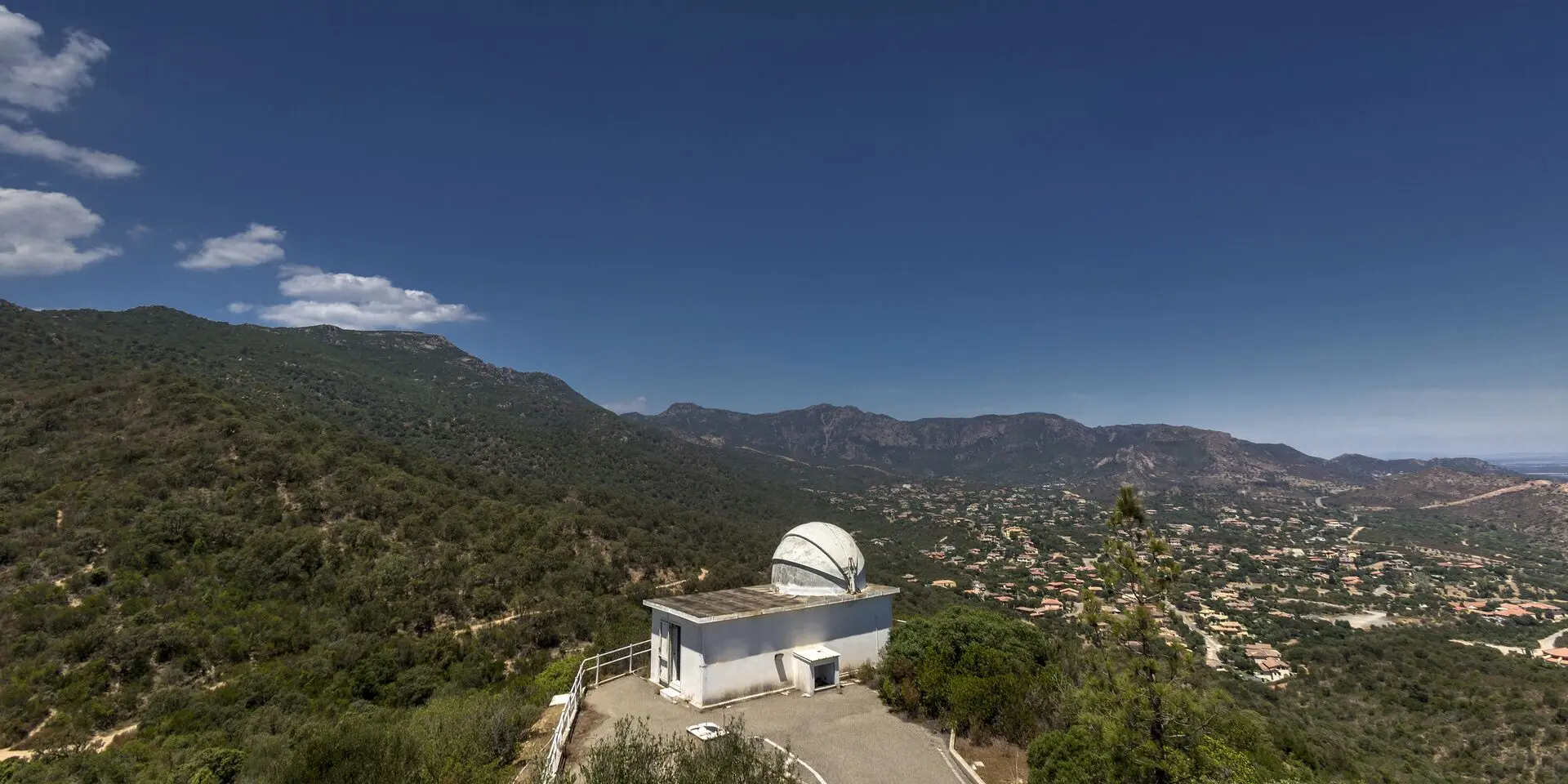
- Poggio dei Pini, a residential hillside neighbourhood that came into being in 1966, surrounded by lush vegetation. It is home to the astronomical observatory and the World War II military bunkers of Pauliara.
Le famiglie fondatrici
In 1655 Baron Torrelas summoned families from the Logudoro and Gallura regions. The surnames of the first settlers — Atzori, Dessì, Piras, Perra, Casu, Farigu, Melis, Lecca, Cossu, Boi, Lai, Porcu, Piano — are still among the most common in Capoterra today. The Paire family arrived from the Pitti territory in the eighteenth century. In the first census of 1656, the village counted just 7 hearths, roughly 28 souls.
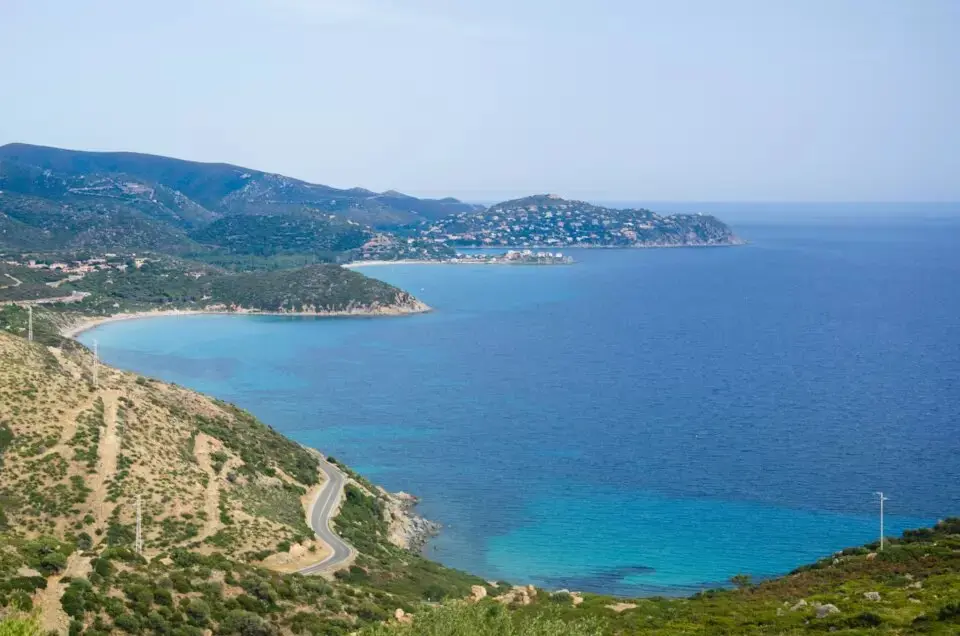
Il paesaggio
Within just a few kilometres the landscape shifts from sea level to the heights of the Sulcis. A coastal lagoon with flamingos, the agricultural plain of the Campidano, hills of Mediterranean scrub, and mountain forests within the Gutturu Mannu Park. The climate is mild: hot summers and temperate winters, with rainfall concentrated between October and March.
La trasformazione del paesaggio
In 1655, when the first settlers arrived, the land was covered with oak forests and Mediterranean scrub, roamed by deer, fallow deer and wild boar. The historian Fara had described it as 'completely deserted and wooded with wild animals'. The colonists cleared the land to create pastures and wheat fields.
In the 1960s the chemical industry established itself near Santa Gilla, and demand for second homes from Cagliari drove coastal urbanisation. The population doubled within a few decades. What remains of the original landscape is the Scardaglia forest, the Gutturu Mannu Park and the lagoon.
Posizione e collegamenti
Capoterra borders Assemini to the north, Sarroch to the south and Uta to the west. The SS 195 connects it to Cagliari in 15 minutes and to Elmas airport in 10. Chia, Teulada and the Sulcis region are less than an hour away.
Neighbouring municipalities
Capoterra borders five municipalities in the Metropolitan City of Cagliari, spread across the coast, the Campidano plain and the Sulcis-Iglesiente mountains.
-
Cagliari
Southeast, across the Santa Gilla lagoon
-
Assemini
Northeast, through the Macchiareddu industrial area
-
Uta
North, on the Campidano plain
-
Villa San Pietro
West, along the coast
-
Sarroch
Southwest, on the coastline toward Pula